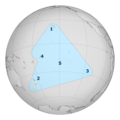
Waihona:Polynesia-triangle.png
Appearance

Ka nui o kēia nāmua: 600 × 600 mau pikela. Other resolutions: 240 × 240 mau pikela | 480 × 480 mau pikela | 768 × 768 mau pikela | 1,024 × 1,024 mau pikela | 1,868 × 1,868 mau pikela.
Waihona kumu (1,868 x 1,868 pikela, nui waihona: 502 KB, ʻano MIME: image/png)
Mōʻaukala waihona
Kāomi ma ka lā/hola no ka nānā ʻana i ka waihona ma kēlā manawa.
| Lā/Hola | Kiʻiliʻi | Nā Nui | Mea ho‘ohana | Kaumanaʻo | |
|---|---|---|---|---|---|
| okamanawa | 03:29, 16 Iune 2013 |  | 1,868 × 1,868 (502 KB) | AnonMoos | adjust margins |
| 20:44, 26 'Okakopa 2010 |  | 2,000 × 2,000 (609 KB) | Kahuroa | include Norfolk Island | |
| 05:10, 26 'Okakopa 2010 |  | 2,000 × 2,000 (619 KB) | Kahuroa | more colour for background | |
| 05:00, 26 'Okakopa 2010 |  | 2,000 × 2,000 (577 KB) | Kahuroa | New version, more accurate | |
| 05:08, 22 Kepakemapa 2010 |  | 726 × 726 (98 KB) | Kahuroa | Reverted to version as of 08:11, 15 September 2007 - will upload new version once it is made | |
| 04:46, 22 Kepakemapa 2010 |  | 726 × 726 (126 KB) | Kahuroa | Reverted to version as of 01:17, 15 September 2007 | |
| 08:11, 15 Kepakemapa 2007 |  | 726 × 726 (98 KB) | Reisio | 'Rotuma in the northern Fijian islands and some of the Lau group to Fiji's southeast have strong polynesian character too.' -- w:Polynesia (rvl) | |
| 01:17, 15 Kepakemapa 2007 |  | 726 × 726 (126 KB) | Kahuroa | <div style="float: left;">'''لغة عربية:''' #? #هاواي #نيوزيلندا #? #? #تاهيتي</div> <div style="float: left;">'''[[:br:Brezhoneg|Brezhone | |
| 22:28, 14 Kepakemapa 2007 |  | 726 × 726 (103 KB) | Kahuroa | <div style="float: left;">'''لغة عربية:''' #? #هاواي #نيوزيلندا #? #? #تاهيتي</div> <div style="float: left;">'''[[:br:Brezhoneg|Brezhone | |
| 04:09, 22 'Okakopa 2005 |  | 726 × 726 (98 KB) | Reisio | make language neutral |
Nā Hana waihona
Loulou kēia mau ‘ao‘ao 2 i kēia waihona:
Global file usage
The following other wikis use this file:
- Usage on af.wikipedia.org
- Usage on als.wikipedia.org
- Usage on ar.wikipedia.org
- Usage on az.wikipedia.org
- Usage on br.wikipedia.org
- Usage on bs.wikipedia.org
- Usage on ca.wikipedia.org
- Usage on cs.wikipedia.org
- Usage on cv.wikipedia.org
- Usage on cy.wikipedia.org
- Usage on da.wikipedia.org
- Usage on de.wikipedia.org
- Usage on el.wikipedia.org
- Usage on en.wikipedia.org
- Usage on en.wiktionary.org
- Usage on eo.wikipedia.org
- Usage on es.wikipedia.org
- Usage on fa.wikipedia.org
- Usage on fr.wikipedia.org
- Usage on fr.wiktionary.org
- Usage on fy.wikipedia.org
- Usage on gl.wikipedia.org
- Usage on gl.wiktionary.org
- Usage on he.wikipedia.org
View more global usage of this file.
