
Waihona:Claiborne Pell Newport Bridge.jpg
Ka nui o kēia nāmua: 800 × 536 mau pikela. Other resolutions: 320 × 214 mau pikela | 640 × 428 mau pikela | 1,024 × 685 mau pikela | 1,280 × 857 mau pikela | 2,560 × 1,714 mau pikela | 3,872 × 2,592 mau pikela.
Waihona kumu (3,872 x 2,592 pikela, nui waihona: 5.22 MB, ʻano MIME: image/jpeg)
Hōʻuluʻulu manaʻo
| Description |
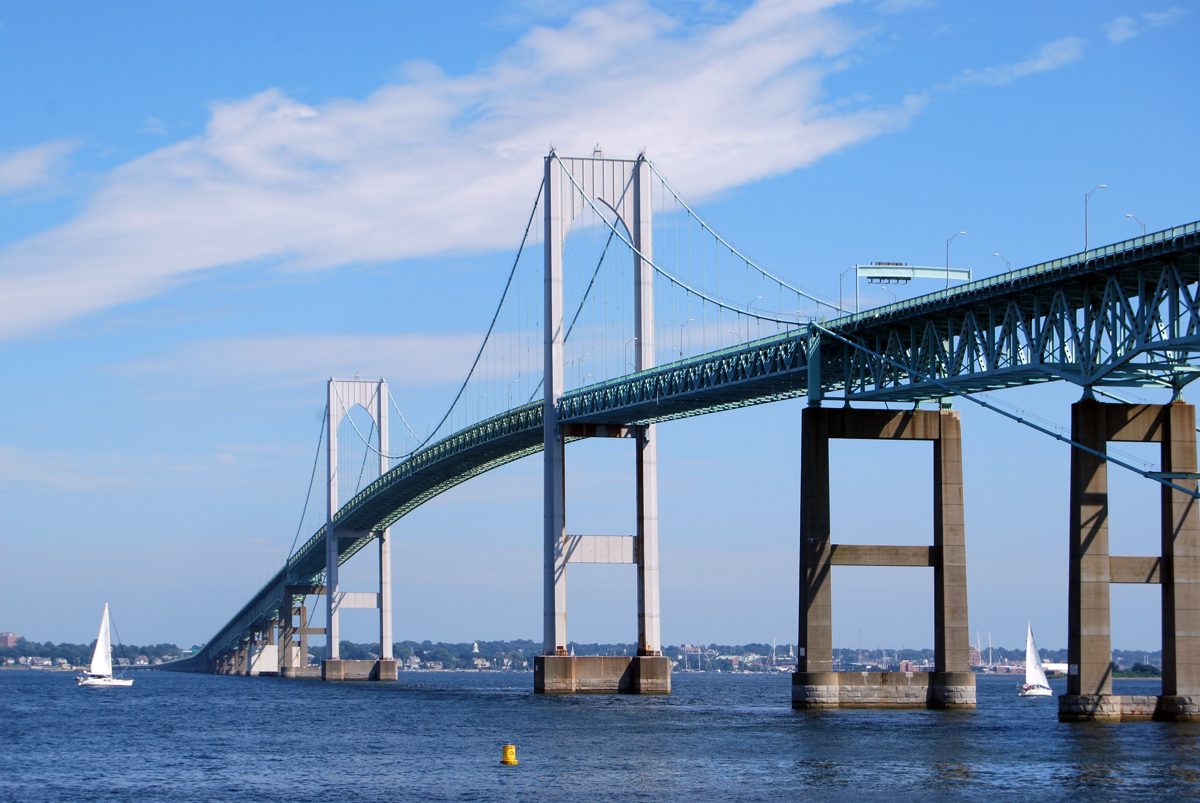
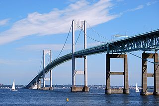
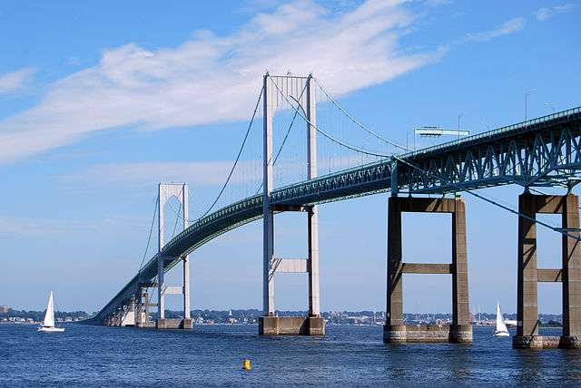
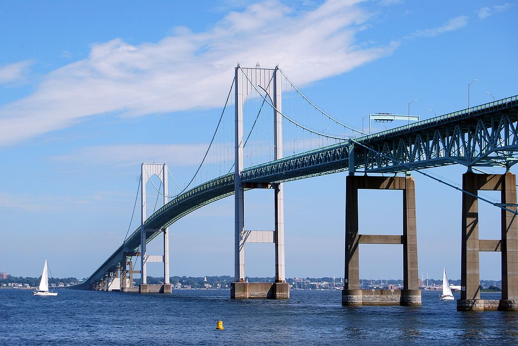
English: The Claiborne Pell Newport Bridge in Newport, Rhode Island, United States, a suspension bridge that connects Newport and Jamestown, crossing the Narragansett Bay. It was built in 1969 and is featured on the reverse of the Rhode Island quarter. |
| Date | |
| Source | Own work |
| Author | UpstateNYer |
| Camera location | | View this and other nearby images on: OpenStreetMap |
|---|
 |
This image or media was taken or created by Matt H. Wade. To see his entire portfolio, click here. @thatmattwade
|
Laikini
I, the copyright holder of this work, hereby publish it under the following license:
This file is licensed under the Creative Commons Attribution-Share Alike 3.0 Unported license.
- You are free:
- to share – to copy, distribute and transmit the work
- to remix – to adapt the work
- Under the following conditions:
- attribution – You must give appropriate credit, provide a link to the license, and indicate if changes were made. You may do so in any reasonable manner, but not in any way that suggests the licensor endorses you or your use.
- share alike – If you remix, transform, or build upon the material, you must distribute your contributions under the same or compatible license as the original.
Mōʻaukala waihona
Kāomi ma ka lā/hola no ka nānā ʻana i ka waihona ma kēlā manawa.
| Lā/Hola | Kiʻiliʻi | Nā Nui | Mea ho‘ohana | Kaumanaʻo | |
|---|---|---|---|---|---|
| okamanawa | 03:28, 13 'Aukake 2009 | | 3,872 × 2,592 (5.22 MB) | MattWade | {{Information |Description={{en|1=The en:Claiborne Pell Newport Bridge in Newport, en:Rhode Island, en:United States, a en:suspension bridge that connects Newport and [[:en:Jamestown, Rhode Island|Jame |
Nā Hana waihona
Loulou kekahi ‘ao‘ao i kēia waihona:
Global file usage
The following other wikis use this file:
- Usage on an.wikipedia.org
- Usage on arz.wikipedia.org
- Usage on bat-smg.wikipedia.org
- Usage on be.wikipedia.org
- Usage on br.wikipedia.org
- Usage on cy.wikipedia.org
- Usage on de.wikipedia.org
- Usage on el.wikipedia.org
- Usage on en.wikipedia.org
- Newport, Rhode Island
- East Greenwich, Rhode Island
- Warwick, Rhode Island
- Jamestown, Rhode Island
- Little Compton, Rhode Island
- Middletown, Rhode Island
- Portsmouth, Rhode Island
- Cranston, Rhode Island
- Narragansett, Rhode Island
- North Kingstown, Rhode Island
- Bristol, Rhode Island
- Tiverton, Rhode Island
- Narragansett Bay
- Point Judith, Rhode Island
- Aquidneck Island
- Conanicut Island
- Prudence Island
- Blackstone River
- Taunton River
- Quonset Point
- Naval Station Newport
- Mount Hope Bridge
- Sakonnet River
- Claiborne Pell Newport Bridge
- Point Judith Light
- Rose Island Light
- Stone Bridge (Rhode Island)
- Rhode Island Route 138
- Jamestown Verrazzano Bridge
- Jamestown Bridge
- Sakonnet River Bridge
- Seekonk River
- Pawtuxet River
- Hope Island (Rhode Island)
- Davisville, Rhode Island
- Newport Harbor Light
- Goat Island (Rhode Island)
- Patience Island
- Dutch Island (Rhode Island)
- Gould Island (Rhode Island)
- Dyer Island (Rhode Island)
View more global usage of this file.