
Waihona:Nouvelle-Calédonie collectivity location map.svg

Size of this PNG preview of this SVG file: 800 × 295 mau pikela. Other resolutions: 320 × 118 mau pikela | 640 × 236 mau pikela | 1,024 × 377 mau pikela | 1,280 × 471 mau pikela | 2,560 × 942 mau pikela | 1,608 × 592 mau pikela.
Waihona kumu (Waihona SVG, 1,608 x 592 mau pikela, nui waihona: 207 KB)
Hōʻuluʻulu manaʻo
| Camera location | | View this and other nearby images on: OpenStreetMap |
|---|
| Description |
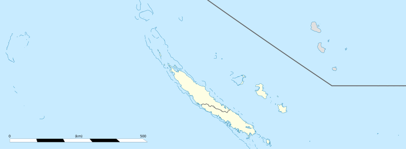
English: Blank administrative map of the territorial collectivity of New Caledonia, France, for geo-location purpose.
This is a general map allowing to geo-locate remote islands. For maps centered on the main islands, see below. Français : Carte administrative vierge de la collectivité territoriale de Nouvelle-Calédonie, France, destinée à la géolocalisation. Ceci est une carte générale permettant la géolocalisation des îles isolées. Pour des cartes centrées sur les îles principales, voir plus bas. Equirectangular projection, WGS84 datum
Geographic limits of the map:
|
||
| Date | |||
| Source |
Own work
|
||
| Author | Eric Gaba (Sting - fr:Sting) | ||
| Permission (Reusing this file) |
|
||
| Other versions |
|


Laikini
I, the copyright holder of this work, hereby publish it under the following licenses:
This file is licensed under the Creative Commons Attribution-Share Alike 3.0 Unported license.
- You are free:
- to share – to copy, distribute and transmit the work
- to remix – to adapt the work
- Under the following conditions:
- attribution – You must give appropriate credit, provide a link to the license, and indicate if changes were made. You may do so in any reasonable manner, but not in any way that suggests the licensor endorses you or your use.
- share alike – If you remix, transform, or build upon the material, you must distribute your contributions under the same or compatible license as the original.

|
Permission is granted to copy, distribute and/or modify this document under the terms of the GNU Free Documentation License, Version 1.2 or any later version published by the Free Software Foundation; with no Invariant Sections, no Front-Cover Texts, and no Back-Cover Texts. A copy of the license is included in the section entitled GNU Free Documentation License. |
You may select the license of your choice.
Mōʻaukala waihona
Kāomi ma ka lā/hola no ka nānā ʻana i ka waihona ma kēlā manawa.
| Lā/Hola | Kiʻiliʻi | Nā Nui | Mea ho‘ohana | Kaumanaʻo | |
|---|---|---|---|---|---|
| okamanawa | 15:26, 4 'Aukake 2013 | 1,608 × 592 (207 KB) | Szczureq | removed non-existent Sandy Island | |
| 03:07, 21 Ianuali 2009 | 1,608 × 592 (177 KB) | Sting | == Summary == {{Location|20|22|30|S|165|10|30|E|scale:5000000}} <br/> {{Information |Description={{en|Blank administrative map of the territorial collectivity of New Caledonia, France, for |
Nā Hana waihona
ʻAʻohe ʻaoʻao e loulou i kēia waihona.
Global file usage
The following other wikis use this file:
- Usage on ba.wikipedia.org
- Usage on bn.wikipedia.org
- Usage on de.wikipedia.org
- Usage on fr.wikipedia.org
- Aquarium des lagons
- Îles Chesterfield
- Province Nord (Nouvelle-Calédonie)
- Grande Terre (Nouvelle-Calédonie)
- Nouvelle-Calédonie
- Centre culturel Tjibaou
- Communauté du Pacifique
- Aéroport international de Nouméa-La Tontouta
- Province Sud (Nouvelle-Calédonie)
- Aéroport de Magenta
- Place des Cocotiers
- Géographie de la Nouvelle-Calédonie
- Fayaoué
- Prise d'otages d'Ouvéa
- Hippodrome Henri-Milliard
- Lekine
- Île Hunter (Pacifique Sud)
- Île Matthew
- Île Walpole (Nouvelle-Calédonie)
- Hôpital Gaston-Bourret
- Hôpital de Magenta
- Centre hospitalier territorial Gaston-Bourret de Nouvelle-Calédonie
- Centre hospitalier spécialisé Albert-Bousquet
- Polyclinique de l'Anse Vata
- Clinique Magnin
- Clinique de la Baie des Citrons
- Modèle:Infobox Tribu de Nouvelle-Calédonie
- Barrage de Yaté
- Cœur de Voh
- Expédition d'Entrecasteaux
- Université de la Nouvelle-Calédonie
- Fort Teremba
- Parc zoologique et forestier Michel-Corbasson
- Foire de Bourail
- Plage de Poé
- Modèle:Géolocalisation/Nouvelle-Calédonie
- Stade Numa-Daly
- Wikipédia:Atelier graphique/Cartes/Archives/Demandes mises en sommeil
- Récifs d'Entrecasteaux
- Gossanah
View more global usage of this file.