
Waihona:Bartonsville Covered Bridge.jpg
Ka nui o kēia nāmua: 800 × 482 mau pikela. Other resolutions: 320 × 193 mau pikela | 640 × 386 mau pikela | 1,024 × 617 mau pikela | 1,280 × 772 mau pikela | 2,100 × 1,266 mau pikela.
Waihona kumu (2,100 x 1,266 pikela, nui waihona: 547 KB, ʻano MIME: image/jpeg)
|
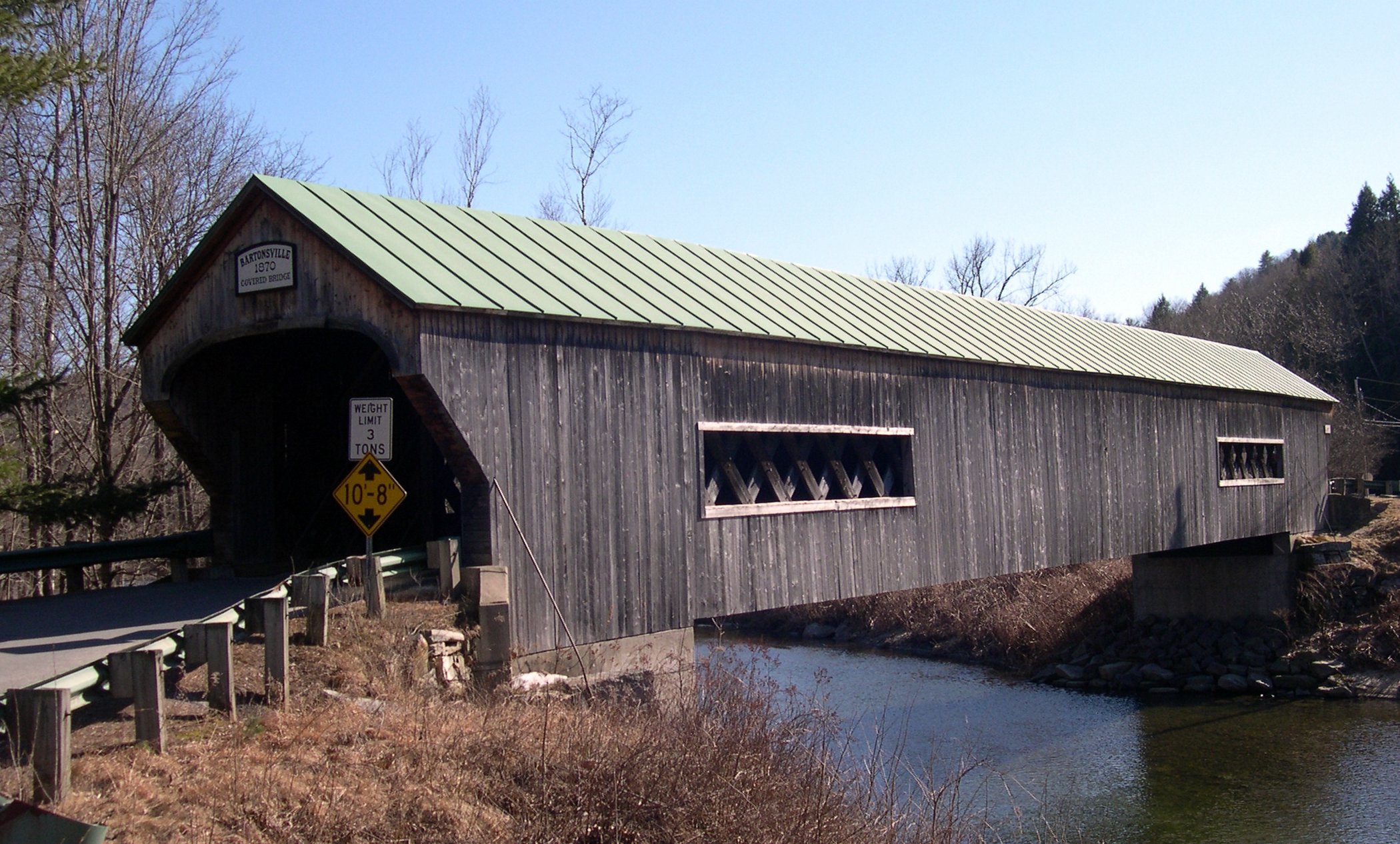
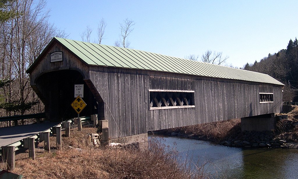
This is an image of a place or building that is listed on the National Register of Historic Places in the United States of America. Its reference number is 73000201. |
Hōʻuluʻulu manaʻo
Bartonsville Covered Bridge, Bartonsville, Rockingham, Vermont
Laikini
I, the copyright holder of this work, hereby publish it under the following licenses:

|
Permission is granted to copy, distribute and/or modify this document under the terms of the GNU Free Documentation License, Version 1.2 or any later version published by the Free Software Foundation; with no Invariant Sections, no Front-Cover Texts, and no Back-Cover Texts. A copy of the license is included in the section entitled GNU Free Documentation License. |
| This file is licensed under the Creative Commons Attribution-Share Alike 3.0 Unported license. | ||
| ||
| This licensing tag was added to this file as part of the GFDL licensing update. |
This file is licensed under the Creative Commons Attribution-Share Alike 2.5 Generic, 2.0 Generic and 1.0 Generic license.
- You are free:
- to share – to copy, distribute and transmit the work
- to remix – to adapt the work
- Under the following conditions:
- attribution – You must give appropriate credit, provide a link to the license, and indicate if changes were made. You may do so in any reasonable manner, but not in any way that suggests the licensor endorses you or your use.
- share alike – If you remix, transform, or build upon the material, you must distribute your contributions under the same or compatible license as the original.
You may select the license of your choice.
| Object location | | View this and other nearby images on: OpenStreetMap |
|---|
Mōʻaukala waihona
Kāomi ma ka lā/hola no ka nānā ʻana i ka waihona ma kēlā manawa.
| Lā/Hola | Kiʻiliʻi | Nā Nui | Mea ho‘ohana | Kaumanaʻo | |
|---|---|---|---|---|---|
| okamanawa | 01:19, 28 Malaki 2006 | | 2,100 × 1,266 (547 KB) | Sfoskett~commonswiki | Bartonsville Covered Bridge, Bartonsville, Rockingham, Vermont Category:Vermont covered bridges |
Nā Hana waihona
Loulou kekahi ‘ao‘ao i kēia waihona:
Global file usage
The following other wikis use this file:
- Usage on am.wikipedia.org
- Usage on ang.wikipedia.org
- Usage on an.wikipedia.org
- Usage on az.wikipedia.org
- Usage on bcl.wikipedia.org
- Usage on be-tarask.wikipedia.org
- Usage on be.wikipedia.org
- Usage on bg.wikipedia.org
- Usage on bi.wikipedia.org
- Usage on co.wikipedia.org
- Usage on cv.wikipedia.org
- Usage on cy.wikipedia.org
- Usage on da.wikipedia.org
- Usage on de.wikipedia.org
- Usage on diq.wikipedia.org
- Usage on el.wikipedia.org
- Usage on en.wikipedia.org
- Usage on et.wikipedia.org
- Usage on eu.wikipedia.org
- Usage on fo.wikipedia.org
- Usage on frp.wikipedia.org
- Usage on frr.wikipedia.org
- Usage on gd.wikipedia.org
- Usage on gl.wikipedia.org
- Usage on gn.wikipedia.org
- Usage on hif.wikipedia.org
- Usage on hi.wikipedia.org
- Usage on hr.wikipedia.org
- Usage on ik.wikipedia.org
- Usage on incubator.wikimedia.org
- Usage on io.wikipedia.org
- Usage on is.wikipedia.org
- Usage on jv.wikipedia.org
- Usage on kab.wikipedia.org
- Usage on ku.wikipedia.org
- Usage on kw.wikipedia.org
- Usage on la.wikipedia.org
- Usage on li.wikipedia.org
- Usage on mhr.wikipedia.org
- Usage on mk.wikipedia.org
- Usage on ml.wikipedia.org
- Usage on mrj.wikipedia.org
- Usage on ms.wikipedia.org
- Usage on nn.wikipedia.org
- Usage on no.wikipedia.org
View more global usage of this file.