
Waihona:Ryukyu orthographic.svg

Size of this PNG preview of this SVG file: 537 × 537 mau pikela. Other resolutions: 240 × 240 mau pikela | 480 × 480 mau pikela | 768 × 768 mau pikela | 1,024 × 1,024 mau pikela | 2,048 × 2,048 mau pikela.
Waihona kumu (Waihona SVG, 537 x 537 mau pikela, nui waihona: 800 KB)
Hōʻuluʻulu manaʻo
| Description |
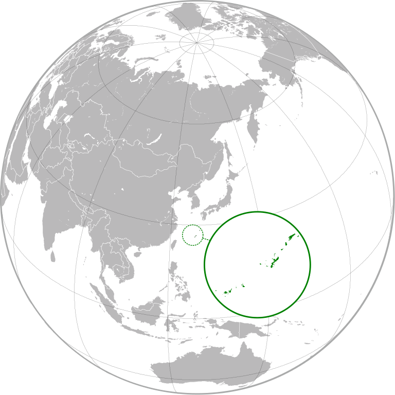
English: Orthographic Projection of Ryukyu Kingdom. 日本語: 琉球王国の位置図 中文(中国大陆):琉球国地理位置 中文(臺灣):琉球國地理位置 한국어: 류큐국의 지리학적 지도. |
| Date | |
| Source | Own work |
| Author | Garam |
| Other versions | |
| SVG genesis | This W3C-invalid world map was created with Adobe Illustrator. |
.svg)
Laikini
I, the copyright holder of this work, hereby publish it under the following licenses:

|
Permission is granted to copy, distribute and/or modify this document under the terms of the GNU Free Documentation License, Version 1.2 or any later version published by the Free Software Foundation; with no Invariant Sections, no Front-Cover Texts, and no Back-Cover Texts. A copy of the license is included in the section entitled GNU Free Documentation License. |
This file is licensed under the Creative Commons Attribution 3.0 Unported license.
- You are free:
- to share – to copy, distribute and transmit the work
- to remix – to adapt the work
- Under the following conditions:
- attribution – You must give appropriate credit, provide a link to the license, and indicate if changes were made. You may do so in any reasonable manner, but not in any way that suggests the licensor endorses you or your use.
You may select the license of your choice.
Mōʻaukala waihona
Kāomi ma ka lā/hola no ka nānā ʻana i ka waihona ma kēlā manawa.
| Lā/Hola | Kiʻiliʻi | Nā Nui | Mea ho‘ohana | Kaumanaʻo | |
|---|---|---|---|---|---|
| okamanawa | 15:55, 26 Ianuali 2013 | | 537 × 537 (800 KB) | Mps2 | |
| 15:13, 26 Ianuali 2013 |  | 537 × 537 (802 KB) | Mps2 | vector inlay (vector data from File:Карта Японии.svg) | |
| 12:22, 23 Kepakemapa 2012 |  | 537 × 537 (674 KB) | Garam | Reverted to version as of 12:12, 23 September 2012 | |
| 12:21, 23 Kepakemapa 2012 |  | 537 × 537 (676 KB) | Garam | Fix | |
| 12:18, 23 Kepakemapa 2012 |  | 537 × 537 (676 KB) | Garam | Fix | |
| 12:12, 23 Kepakemapa 2012 |  | 537 × 537 (674 KB) | Garam | Fix | |
| 12:11, 23 Kepakemapa 2012 |  | 537 × 537 (676 KB) | Garam | {{Information |Description ={{en|1=Orthographic Projection of Ryukyu Kingdom.}} |Source ={{Self}} |Author =~~~ |Date =2012-09-22 |Permission = |other_versions = }} * File:Map of Ryukyu Kingdom.png * [[:File:Japan (... |
Nā Hana waihona
Loulou kekahi ‘ao‘ao i kēia waihona:
Global file usage
The following other wikis use this file:
- Usage on af.wikipedia.org
- Usage on ar.wikipedia.org
- Usage on ast.wikipedia.org
- Usage on azb.wikipedia.org
- Usage on ca.wikipedia.org
- Usage on cs.wikipedia.org
- Usage on da.wikipedia.org
- Usage on de.wikipedia.org
- Usage on en.wikipedia.org
- Usage on eo.wikipedia.org
- Usage on es.wikipedia.org
- Usage on eu.wikipedia.org
- Usage on fa.wikipedia.org
- Usage on fi.wikipedia.org
- Usage on fr.wikipedia.org
- Usage on fr.wiktionary.org
- Usage on gan.wikipedia.org
- Usage on gl.wikipedia.org
- Usage on hak.wikipedia.org
- Usage on he.wikipedia.org
- Usage on hu.wikipedia.org
- Usage on id.wikipedia.org
- Usage on incubator.wikimedia.org
- Usage on it.wikipedia.org
- Usage on ja.wikipedia.org
- Usage on ko.wikipedia.org
- Usage on oc.wikipedia.org
- Usage on pl.wikipedia.org
View more global usage of this file.